Muckle Spate and Sunflower Update

November sunflower: supported by invisible puppet strings from the heavens
Now there have been spates and floods before. Weather in Scotland, or Ultima Thule, is and always has been the topic which gets most discussion year-round. It’s because of its location:
Americans in particular are amazed to learn that the Moray Firth in Scotland lies at the same latitude as Juneau, Alaska.
For the latitude of Ultima Thule, the farthest and northernmost point of habitable land, read nine degrees below the Arctic Circle, or what is euphemistically named the Northern Temperate Zone. So it’s not unreasonable to experience weather conditions which are enormously influenced by the Atlantic Ocean on one coast and the North Sea on the other.

The powerful warm Gulf Stream current maintains waters mild in Ultima Thule
For those not aware of these obscure locations in an otherwise frozen belt of Icelandic waters, GoogleEarth will happily provide up-to-the-minute and up-to-the last aerially-photographed section of the Moray Firth, Orkney and Shetland Isles and Mainland Scotland.

The River Deveron near Duff House at Banff
The fact that these new houses were built on ‘flood-plain’ in the first place is something this blogger prefers not to discuss at this point.
Abnormally high rainfall in September washed out roads in the Highlands and Scotland’s West Coast at Oban and Skye. Over a four-day period in October, rivers Don and Dee in Aberdeenshire overflowed and took out roads and bridges in Banchory, Kintore and Inverurie and claimed the life of a farmer. The Rivers Spey and the Lossie at Elgin on the Moray coast reached record high levels. The Deveron at Banff flooded golf courses, links, part of the Old Town and made the A98 coast road impassible.

One of Gen. Wade's bridges a little worse for wear
Aberdeenshire’s North Coast shares something in common with those river valleys in the glacial excavation grinding through the Mounth, the Cairngorms, and the Grampian and Ladder Hills. They have always had extremes of weather. Prophets of global warming suggested cooling temperatures for North Britain in 2005. Yet in the interim, except for the Wet Summer of 2009, Scotland has experienced record high temperatures. House building in floodplains has progressed apace. No wonder Mother Nature decided this year to rebel and balance the books.
She did something similar in the summer of 1829. It was the year of the Great Flood, or in the Northeast vernacular, The Muckle Spate o’ ’29.
If records are to be believed, three months’ worth of rain fell in one week in August of that year, inundating crops and farmland, transporting cattle, sheep, dogs and men from their homes downstream for miles. Bridges were heavy casualties. Even those robust granite bridges built by General George Wade (1673-1748) in 1724 to withstand the weight of his marching troops and to guide his mapmakers through the wilds of Scotland on their first attempt to document the country for King George I. But two centuries have elapsed since then and road- and bridge-building has advanced a pace. Or have they?

Turra United: the fitba' pitch at Turriff, Aberdeenshire
For all our computer-generated map-making and architect-free design models of flood plains, physical geography and world climate patterns, one would think we had learned something. Last week’s freak storm suggests we haven’t.
I thought you’d like to read a brief excerpt from the vernacular poem ‘The Muckle Spate o’ ‘Twenty-nine’ by David Grant, published in 1915 by the Bon-Accord Press, Aberdeen. Its subject matter was focused on the River Dee at Strachan (pronounced Stra’an) – a mile of so from the base of the Mounth. If you need a translation, I might suggest you ask someone from the ‘old school’ and keep handy a copy of Aberdeen University Press‘s Concise Scots Dictionary. Enjoy.

Giant sunflower and stone circle after three storms
It rained again today after three days of watery sun. I think she may still have time to stretch herself into the record books: as the latest-bloomer of all time to brave insane weather and still reach her goal: the Giant Sunflower of Ultima Thule. Spates be damned.
The Muckle Spate o’ ‘Twenty-Nine by David Grant
‘At Ennochie a cluckin’ hen wis sittin’ in a kist,
Baith it an’ her were sweelt awa’ afore the creatur’ wist;
We saw her passin’ near Heugh-head as canty as ye like,
Afore her ark a droonit stirk, ahint a droonit tyke,
An’ ran anent her doon the banks for half-a-mile or mair,
Observin’ that, at ilka jolt, she lookit unca scare,
As gin she said within hersel’ – ‘Faur ever am I gyaun?
I nivver saw the like o’ this in Birse nor yet in Stra’an.
Faur ever am I gyaun, bairns? Nae canny gait, I doot;
Gin I cud but get near the side, I think I wad flee oot.’
We left her near the Burn o’ Frusk, an’ speculatit lang
Gin she were carri’t to the sea afore her ark gaed wrang,
An’ may be spairt by Davie Jones to bring her cleckin’ oot,
Gin she wad rear them like a hen or like a water coot.’
4 Comments »
Leave a reply to Space Weather Update: Earth fights back « Youngblood Blog Cancel reply
 The Stellar Perspective
- Oriental Year of Dragon 2024 & Lunar New Year Zodiac
- Early Saints & Religious Houses in Scotland with Placenames derived from Pictish/Brittonic/Celtic
- U.S. Memorial Day Means Different Strokes for Different Folks
- Hokole’a Hawai’ian-built Canoe to Circumnavigate Pacific— 47,000 Miles over Next Four Years
- Time to Tempt Humans to Act like Telosians—Delving Deep Within to Discover our Origins As Star-People
- Canticle for a lost Nation—Pictish Roots Surface in Stone, Royal Forests & Names
- The Janus Effect—Riding into the New on an Old Horse
- Boudicca: Great Queen of the Iceni
- 2020 Backward Take on 2012: Stargate Portal to Final Quarter
- Volcanic Surprise: Take your Toys and Go Home
Solar & Geomagnetic field indicator (NOAA)
From n3kl.orgSolar X-rays:
Geomagnetic Field:

- Derilea’s Dream: Pictish essentials
- The Glory that Was Sail
- Guest Blog from the Granite Past to a Future Historian
- Boudicca: Great Queen of the Iceni
- The Sueno’s Stone Cover-up
- Maiden Stone of Bennachie
- Bibliography: The Church in Pictland
- Warlord centres of Pictland:glimpses into a lost history
- Gaels progress through Pictland via the Church
- Hello world!
Shakeout prepared

Picosecond Pulse Ripples Gold on Glass
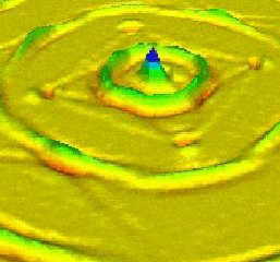
Vibrational sound in picoseconds
Recent Comments
Marian’s SHASTA:Critical Mass

Earth speaks wolves listen—a New Age tale

bumpy ride ahead

‘Phantom’s Child’

Nano 2011 win

SHASTA: backstory
Circlemakers

Enceladus 2017
Enchantment

ShakeOut preparedness

Bourtie Kirk: 800 Years

Geometry code

- Devorguilablog: view from Pictish Citadel
- Pictish Power Centre discovered at Rhynie: stronghold in Aberdeenshire heartland
- Black Glen Cailleach/Bodach Stones threatened
- PICTISH KINGLISTS and the PICTISH CHRONICLE
- Nechtan’s Pictish Nation: 8thC Strongholds of the new religion
- Pictish inheritance in an ancient land
- Canticle for a lost Nation
- Canticle III: Nechtan of Derley
- Devorguila’s lineage: where did it go?
cosmic consciousness


When Dee and Don shall run as One
And Tweed shall run with Tay
The bonnie waters o’ the Ury
Shall bear the Bass away
attrib. to Thomas the Rhymer, Thomas of Ercildoune
[…] on the westernmost limb of the North Sea’s mild Gulf Stream current, its dry climate (usually, rain from the west is captured by the Grampian mountains before […]
Pingback by Space Weather Update: Earth fights back « Youngblood Blog | January 27, 2010 |
[…] The September ‘spate’, likened to its ancestor, the ‘Muckle Spate o’ ‘29’ (by that they meant 1829), carried away everything not tied down: including fish, stone and tree. […]
Pingback by 2009/2010 El Niño Crazies? or Just Weather « Youngblood Blog | February 23, 2010 |
Most of the time, everyone is usually not confident
that the environment is safe for them to adjust from one structure to another.
If they begin to charge of those once free must-haves, even area
department at work spending may face cuts, meaning they
do not be able to offer you anything cost-free
either?